Your shoreline field guide
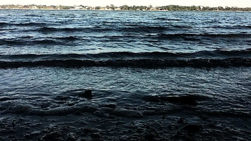
Philippe Park Shoreline
Pinellas · park
Open7 a.m. to sunset, 7 days a week; closed the day after Thanksgiving and December 25Call ahead
Good for
Target species
Style
parkstructureflats
Officially listed features
restrooms
From the official source linked below.
General guidance: Old Tampa Bay shoreline with oyster bars and seawall; reds and black drum feed along the bars on a rising tide.
Wind & weather
Forecast from National Weather Service, updated Oct 25, 7:36 PM ET
Get Tampa Bay access, tides and red tide in your free Friday Shore Report.
We only use your email for the newsletter. Privacy policy.
Conditions can change; check the official source before you go.
| Status | Open |
|---|---|
| Status note | County lists the park open with saltwater fishing; main playground and restrooms 5 and 8 closed for repairs. |
| Address | 2525 Philippe Parkway, Safety Harbor, FL 34695 |
| Hours | 7 a.m. to sunset, 7 days a week; closed the day after Thanksgiving and December 25 |
| Parking / fees | Call ahead — Philippe Park (Pinellas County) · (727) 582-2100 · website |
| Amenities | Picnic shelters with grills, Boat ramp, Water fountains, Restrooms |
| Fishing license | County states saltwater fishing license may be required. Fishing license: who needs one |
Last checked Oct 2026 from Pinellas County: Philippe Park
Fish to target here
General habitat guidance; confirm access and regulations before fishing.
- Redfish Mangroves and oysters give redfish a crustacean-feeding edge to probe with shrimp on rising water.
- Spotted seatrout Old Tampa Bay shoreline with oyster bars and seawall; reds and black drum feed along the bars on a rising tide.
- Mangrove snapper Mangroves and oysters offer tight cover to probe with small shrimp while keeping hooks clear of roots.
- Black drum Oyster shoreline habitat matches black drum feeding on bottom-dwelling shellfish.
Tide chart, next 48 hours
7-day high/low table
Station: Safety Harbor, Old Tampa Bay (8726738) · 2.3 km away. Heights in feet above MLLW; station local time (EST/EDT). Predictions are not observed conditions.
| Date / time | Tide | Feet |
|---|---|---|
| 2026-10-26 03:14 | High | 2.988 |
| 2026-10-26 10:41 | Low | -0.47 |
| 2026-10-26 17:22 | High | 2.098 |
| 2026-10-26 21:45 | Low | 1.495 |
| 2026-10-27 03:43 | High | 3.19 |
| 2026-10-27 11:26 | Low | -0.658 |
| 2026-10-27 18:19 | High | 1.978 |
| 2026-10-27 22:03 | Low | 1.635 |
| 2026-10-28 04:16 | High | 3.325 |
| 2026-10-28 12:15 | Low | -0.721 |
| 2026-10-28 19:24 | High | 1.832 |
| 2026-10-28 22:15 | Low | 1.713 |
| 2026-10-29 04:55 | High | 3.365 |
| 2026-10-29 13:07 | Low | -0.659 |
| 2026-10-30 05:39 | High | 3.289 |
| 2026-10-30 14:06 | Low | -0.498 |
| 2026-10-31 06:29 | High | 3.089 |
| 2026-10-31 15:15 | Low | -0.289 |
| 2026-11-01 06:31 | High | 2.778 |
| 2026-11-01 15:23 | Low | -0.072 |
Red tide (FWC samples, last 8 days)
Nearest sample: Dunedin Municipal Marina (Clearwater Harbor), Oct 19 2026; not present/background (0-1,000); 11.1 km away. Maximum within 15 km: not present/background (0-1,000) (2 samples).
Samples are point-in-time observations; missing samples do not establish safe conditions. Check FWC’s current report.
Sources
OpenClosedCall ahead
Map requires an internet connection. Spot details are listed below.
Spot a change? Email hello@shorereadytampa.com
Get the Friday Shore Report
Which Tampa Bay piers and shore spots are open, plus tides and red tide, every Friday. Free.
We only use your email for the newsletter. Privacy policy.
No spam. Unsubscribe anytime.